
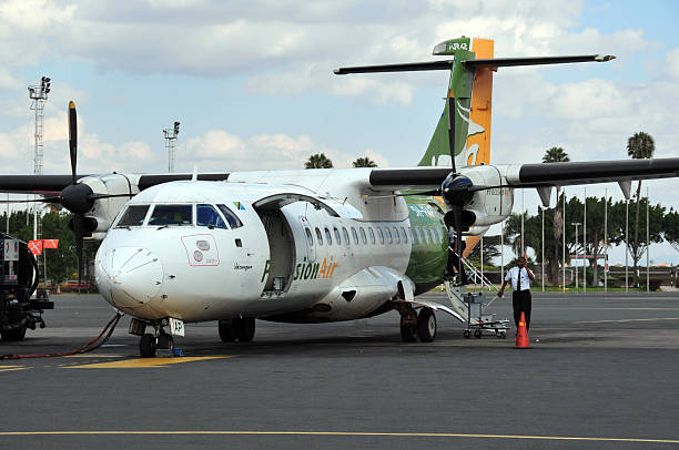

A Ngorongoro Crater geological tour focuses on understanding the formation and volcanic history of this iconic caldera, exploring how its unique geological structure influences the abundant wildlife and the broader ecosystem within its walls, offering a distinct perspective from standard safaris, particularly valuable for planning in 2026-2027.
Unearthing the Earth’s Masterpiece: Your Ngorongoro Crater Geological Tour
The Ngorongoro Crater is more than just a UNESCO World Heritage Site teeming with wildlife; it’s a living testament to Earth’s dynamic geological forces. While many visitors come for the unparalleled game viewing, a Ngorongoro Crater geological tour offers a profound, science-driven exploration of the very forces that sculpted this natural wonder. This journey peels back the layers of the savanna to reveal the dramatic volcanic past and ongoing geological processes that make the crater so unique. For travelers planning their Tanzanian adventure in 2026-2027, understanding the geological underpinnings can significantly enrich the safari experience, providing context for the landscape, the animals, and the very air you breathe.
This isn’t your typical ‘spot the Big Five’ safari, though the wildlife remains a spectacular highlight. Instead, a geological tour emphasizes the monumental volcanic eruption that occurred approximately two to three million years ago, the subsequent caldera collapse, and the subsequent evolution of the crater floor into one of Africa’s most biodiverse habitats. We will examine the types of volcanic rocks, the evidence of past lava flows, the role of faulting and erosion, and how the caldera’s unique topography and water sources create a self-contained ecosystem that sustains a remarkable density of animals year-round.
The Genesis of a Giant: Volcanic Origins of the Ngorongoro Caldera
The story of the Ngorongoro Crater begins with fire and fury. The caldera is the remnant of a massive stratovolcano, a mountain that once rivaled Kilimanjaro in height. Geologists believe this colossal volcano, part of the Great Rift Valley’s volcanic arc, was active for hundreds of thousands of years. Its formation is a classic example of volcanic activity driven by the tectonic forces that shaped East Africa.
The East African Rift Valley itself is a colossal geological feature, a place where the Earth’s crust is slowly pulling apart. This rifting process thins the crust, allowing magma from the mantle to rise closer to the surface. In the Ngorongoro region, this magma fueled volcanic activity, building up immense cones over vast periods. The volcano that preceded the Ngorongoro Crater was likely a majestic peak, its slopes covered in forests, its summit spewing ash and lava.
The dramatic end to this volcano’s life came not from a slow decline, but from a catastrophic event. Scientists theorize that the volcano’s magma chamber, a vast underground reservoir of molten rock, became unstable. This instability likely resulted from a combination of factors: the chamber emptying as lava erupted from the summit, or perhaps a new influx of magma causing pressure build-up. When the chamber could no longer support the weight of the overlying rock, it collapsed inwards. This event, known as caldera collapse, is far more destructive than a typical eruption. Imagine a colossal underground void suddenly giving way; the overlying mountain literally falls into itself, creating a vast, bowl-shaped depression.
The scale of this collapse is difficult to comprehend. The original volcano was likely over 4,500 meters (14,700 feet) high. The subsequent collapse created a caldera with walls rising hundreds of meters above the surrounding highlands, and a floor spanning about 260 square kilometers (100 square miles). This immense bowl, the Ngorongoro Crater we see today, is a direct consequence of this ancient, cataclysmic geological event. Examining the crater rim, particularly from viewpoints like Oloirobi, offers a vantage point to appreciate the sheer scale of this collapse and the dramatic escarpments that define its boundaries.
Evidence in the Landscape: Tracing Volcanic Activity
Even millions of years later, the signs of this intense volcanic past are etched into the landscape. During a geological tour, our guides will point out key features:
- The Crater Walls: These steep, often forested escarpments are the exposed edges of the ancient volcano’s cone, revealing layers of hardened lava flows and ash deposits. They serve as a constant reminder of the immense forces that shaped the caldera.
- Volcanic Rocks: Various rock types, such as basalt and trachytic phonolite, can be identified. Basalt is common in volcanic areas and forms from the rapid cooling of lava. Phonolite, a more silica-rich volcanic rock, is often associated with explosive eruptions.
- Remnant Peaks: Within the crater, smaller volcanic cones and hills, like Mandusi Swamp’s elevated mound, represent later, smaller-scale volcanic activity that occurred after the main caldera collapse. These are geological ‘aftershocks’ or independent vents that arose from residual magma.
- Geothermal Activity: While not as pronounced as in some other Rift Valley locations, subtle signs of geothermal activity can sometimes be observed, such as warm springs, hinting at the heat still present beneath the surface.
Understanding these geological markers transforms a scenic drive into an educational expedition. It allows us to appreciate the raw power that created this extraordinary environment and to see the landscape not just as a backdrop for wildlife, but as a dynamic geological entity.
The Caldera Floor: A Unique Geological and Ecological Crucible
Once the massive caldera formed, a new chapter in its history began: the development of a unique ecosystem within its confines. The geological structure of the Ngorongoro Crater plays a pivotal role in creating and sustaining this exceptional biodiversity.
Hydrology and Water Sources: The Lifeblood of the Crater
The crater floor is not a flat, uniform plain. It features a diverse topography, including grasslands, swamps, a soda lake (Lake Magadi), a small forest (Gorigor Swamp area), and several permanent springs. These water sources are critical for the concentration of wildlife, especially during drier periods.
- Lake Magadi: This shallow, alkaline lake is a prominent feature. Its high salt content is due to evaporation and the concentration of minerals washed in from the surrounding rocks. While not suitable for drinking by most large mammals, it attracts flamingos and other water birds that thrive in such saline environments. The lake’s fluctuating size is a direct indicator of rainfall and evaporation rates, a constant geological and climatic interplay.
- Permanent Springs: Several springs, such as the Ngoitokitok Springs and the Gorigor Springs, provide fresh, reliable water. These are often associated with geological fault lines or areas where underground water systems emerge. These springs become vital gathering points for a vast array of animals, from elephants and hippos to lions and wildebeest.
- Swamps: Areas like Mandusi Swamp and Gorigor Swamp are fed by springs and surface runoff. They provide crucial grazing for herbivores and are favored habitats for hippos and various bird species. The waterlogged soil and vegetation are a direct result of the crater’s topography and its ability to retain water.
The concentration of water sources within the relatively confined space of the crater is a direct consequence of its geological formation. The crater walls act as a natural barrier, trapping rainfall and channeling it towards the lower-lying areas, where springs emerge and the lake forms.
Soil Composition and Vegetation Zones
The soils within the crater are derived from volcanic ash and weathered lava, making them rich in minerals. This fertility supports lush grasslands that are ideal for grazing animals. Different soil types and drainage patterns create distinct vegetation zones:
- Short Grass Plains: Dominated by grasses like Themeda triandra, these open plains are the primary feeding grounds for wildebeest, zebras, gazelles, and buffalo.
- Acacia Woodlands: Scattered acacia trees provide shade and browse for giraffes and elephants.
- Swamp Vegetation: Reeds, sedges, and water-loving grasses thrive in the damper areas, providing food and habitat.
- Forest Patches: The small forested areas, often found on the slopes or near reliable water, offer shelter and specialized food sources.
The geological history has thus created a mosaic of habitats within a single, enclosed landscape. This variety is a key reason for the crater’s exceptional wildlife density, as it can support a wider range of species with different dietary and habitat needs.
Ngorongoro’s Geological Influence on Wildlife Behavior and Distribution
The geological features of the Ngorongoro Crater profoundly influence how wildlife behaves and where animals are found. This is a core element of any geological tour, connecting the earth beneath to the life above.
Concentration of Animals
The most striking aspect of the Ngorongoro Crater is the sheer density of wildlife. This concentration is largely due to the caldera’s topography and the reliable water sources it holds. Animals are drawn to the crater floor for sustenance and water, especially during the dry seasons when water becomes scarce in the surrounding plains. The steep crater walls act as a natural enclosure, making it difficult for many animals to leave, thus keeping them within this fertile basin.
During the annual Great Migration, while the vast herds of wildebeest and zebra traverse the wider Serengeti ecosystem, a significant number often remain within the Ngorongoro Conservation Area and can be found on the crater floor, particularly when grazing is good. This creates a permanent resident population of grazers that supports a healthy population of predators.
Predator-Prey Dynamics
The crater’s varied terrain offers distinct advantages for both predators and prey. The open grasslands are ideal for lion prides to stalk herds of wildebeest and zebras. Hyenas, also abundant, utilize the plains and rocky outcrops. Cheetahs, while less common due to the open terrain favoring lions and hyenas, can be seen hunting gazelles on the flatter expanses. Leopards tend to favor the denser vegetation and rocky areas, often found near the crater rim or in the forested patches.
The presence of waterholes and swamps attracts herbivores, which in turn attract predators. This creates predictable hunting grounds. The geological features, such as the soda lake and dense swamps, can sometimes act as barriers or deterrents, influencing hunting strategies. For instance, predators might avoid the deeper swamps, while prey animals might seek refuge there.
The Role of the Soda Lake
Lake Magadi, with its alkaline waters, is a unique geological feature that impacts the ecosystem. While most animals avoid drinking its water, it is a vital habitat for specific species. The brine shrimp and algae that thrive in the lake are a food source for flamingos, which are often seen in large numbers. The mudflats around the lake also attract various wading birds. This specialized niche created by the lake’s geology means it supports a part of the food web that would otherwise be absent.
Elephant Behavior
Ngorongoro is home to a population of large bull elephants, often identifiable by their impressive tusks. These elephants are unique in that they are largely confined to the crater floor. They utilize the varied vegetation for browsing and feeding. Their movements are influenced by water availability and the presence of acacia trees. Geologists note that the volcanic soils contribute to the mineral content of the vegetation, which may play a role in the health and size of the tusks of these elephants.
Beyond the Caldera: The Wider Ngorongoro Conservation Area
While the Ngorongoro Crater is the star attraction, the surrounding Ngorongoro Conservation Area (NCA) is also a geologically significant region and an integral part of the larger ecosystem. A comprehensive geological tour might extend beyond the crater floor.
The Ngorongoro Highlands and Volcanic Features
The NCA encompasses a vast area of highlands, which are themselves part of the volcanic landscape associated with the Great Rift Valley. This includes other extinct volcanoes and crater formations.
- Olmoti Crater: Smaller than Ngorongoro, Olmoti Crater is known for its beautiful waterfalls and is a source of the Munge River, which flows into the crater. Its geological formation is similar, though on a smaller scale.
- Empakaai Crater: This crater is characterized by a deep, permanent lake at its center, surrounded by steep, forested walls. It offers stunning views and is a significant birding area.
- The Great Rift Valley Escarpment: The NCA sits on the eastern edge of the Great Rift Valley. The dramatic escarpments that define the region are a direct result of the tectonic forces that created the valley.
Exploring these areas provides a broader understanding of the volcanic processes that shaped the entire region, not just the main crater.
Maasai Culture and Geological Interaction
The NCA is also home to the Maasai people, whose traditional pastoral lifestyle is deeply intertwined with the land. Their knowledge of the environment, including water sources and grazing patterns, has been shaped by the geological realities of the area for centuries. Understanding the Maasai culture within the context of the NCA’s geology adds a human dimension to the geological narrative.
For travelers planning for 2026-2027, engaging with local guides who understand both the geology and the cultural heritage offers a richer perspective. They can explain how Maasai communities have historically utilized the land’s resources, often in harmony with the natural geological cycles.
Planning Your Ngorongoro Crater Geological Tour in 2026-2027
A specialized Ngorongoro Crater geological tour requires careful planning to maximize the educational and experiential value. While standard safaris often include a day trip to the crater, a geological focus necessitates a more in-depth approach.
Duration and Itinerary
A typical day trip to the Ngorongoro Crater from Arusha or Karatu is usually rushed and offers limited time for detailed observation. For a geological tour, we recommend at least:
- One Full Day within the Crater: This allows for a thorough exploration of the crater floor, focusing on its diverse habitats, water sources, and wildlife concentrations.
- Optional Extra Day for Highlands: If time and interest permit, an additional day can be dedicated to exploring the surrounding NCA highlands, visiting other crater lakes or viewpoints to appreciate the broader geological context.
- Integration with Other Safaris: This tour can be seamlessly integrated into longer Northern Circuit safaris, which typically include Tarangire National Park, Lake Manyara National Park, and the Serengeti.
Many travelers choose to base themselves in Karatu, a town just outside the NCA, which offers convenient access to the crater. Lodges and camps in this area often provide excellent views and can serve as comfortable bases for your explorations.
Choosing the Right Guide
The expertise of your guide is paramount for a geological tour. Look for tour operators who:
- Employ knowledgeable guides: Guides who have specific training or a strong background in geology or natural history can point out specific rock formations, explain volcanic processes, and connect geological features to wildlife behavior.
- Offer customized itineraries: A good operator will work with you to tailor the tour to your specific interests, whether that’s focusing on specific rock types, understanding water systems, or observing animal adaptations to the environment.
- Provide specialized vehicles: While standard safari vehicles are used, ensuring they are well-maintained and comfortable for longer periods of observation is important.
Best Time to Visit for Geological Interest
While wildlife viewing is excellent year-round in the Ngorongoro Crater due to its permanent resident population, the dry seasons (June to October and December to February) offer the best conditions for geological exploration:
- Dry Grasslands: The vegetation is less dense, making rock formations and soil types more visible.
- Exposed Lakebed: Lake Magadi can recede significantly during dry periods, exposing more of its unique mineral deposits and surrounding mudflats.
- Clearer Skies: Generally, the dry seasons offer clearer skies, improving visibility for landscape observation.
However, the green season (November and March to May) also has its unique appeal, with lush landscapes and fewer crowds. The geological features remain the same, but the visual presentation changes.
Costs and Inclusions for 2026-2027
The cost of a Ngorongoro Crater geological tour is typically part of a larger safari package. Key cost factors include:
- Park Fees: Entry fees for the Ngorongoro Conservation Area are significant and are charged per vehicle and per person. These fees are subject to change, and travelers should expect potential adjustments for 2026-2027.
- Vehicle Hire: The cost of a 4×4 safari vehicle and experienced driver-guide.
- Guide Expertise: Specialized geological guides may incur slightly higher fees than standard safari guides.
- Accommodation: Lodges or camps inside or outside the NCA.
- Duration: Longer tours naturally cost more.
A typical Ngorongoro Crater geological tour, as part of a multi-day safari, might range from $350 to $800+ per person per day, depending on the level of luxury, group size, and specific inclusions. This usually covers park fees, vehicle and guide, accommodation, and meals. It’s always best to get a detailed quote.
Key Considerations for Your 2026-2027 Geological Safari:
- Book in Advance: Especially for peak seasons (June-October, December-January), booking accommodation and safari arrangements well in advance is crucial for 2026-2027.
- Specialized Guide Request: Clearly state your interest in geology when booking to ensure you are matched with an appropriate guide.
- Pack Accordingly: Bring layers of clothing, sturdy walking shoes if any walking is planned (though walking is restricted on the crater floor), binoculars, a good camera, and sun protection.
- Respect the Environment: Follow all park rules, stay on designated tracks, and do not disturb wildlife or geological formations.
Frequently Asked Questions about Ngorongoro Geology Tours
What makes the Ngorongoro Crater geologically unique?
Its uniqueness stems from being a caldera formed by the collapse of a massive volcano. This created a self-contained basin with a rich ecosystem, diverse topography (including a soda lake and swamps), and fertile volcanic soils that support an exceptional density of wildlife.
Is a geological tour different from a standard safari in the Ngorongoro Crater?
Yes. While both offer game viewing, a geological tour emphasizes the volcanic formation, geological features, soil types, water systems, and how these elements influence the landscape and wildlife. Standard safaris focus primarily on animal sightings.
Can I see evidence of the volcanic eruption that formed the crater?
Absolutely. The steep crater walls are composed of layered volcanic rock, evidence of past lava flows and ash deposits. Geologists can also identify specific rock types and smaller volcanic cones that formed after the main collapse.
How does the geology affect the wildlife in the crater?
The geological structure creates a natural enclosure and traps water sources, leading to a high concentration of animals. The varied topography and soil fertility support diverse vegetation, which in turn sustains a wide range of herbivores and their predators.
What is the significance of Lake Magadi within the crater?
Lake Magadi is a shallow, alkaline soda lake. Its high salt content supports specific flora and fauna, such as brine shrimp and algae, which are food for flamingos and other water birds. It’s a direct result of evaporation and mineral accumulation in a low-lying basin.
Is it possible to collect rock samples or conduct geological fieldwork?
No. Collecting samples or conducting independent fieldwork is strictly prohibited within the Ngorongoro Conservation Area to protect its natural and cultural heritage. Geological tours focus on observation and learning from expert guides.
Experience the Geological Heart of Tanzania with Top Guide Adventures
A Ngorongoro Crater geological tour offers an unparalleled opportunity to connect with the raw power of nature and understand the profound geological forces that shaped one of Africa’s most spectacular landscapes. By focusing on the volcanic origins, the unique caldera environment, and the interplay between geology and ecology, you gain a deeper appreciation for this UNESCO World Heritage Site.
Whether you are a geology enthusiast or simply a curious traveler looking for a more insightful safari experience, Top Guide Adventures can craft a journey that meets your needs for 2026-2027. Our expert guides are passionate about sharing the wonders of Tanzania, from its geological marvels to its vibrant wildlife and rich cultural heritage. We specialize in creating custom safari itineraries that go beyond the ordinary, ensuring your trip is both educational and unforgettable.
Ready to explore the geological wonders of the Ngorongoro Crater? Contact us today to start planning your bespoke adventure. You can reach us via WhatsApp at +255616946642, email us at topguideadventures@gmail.com, or use our backup email info@topguideadventures.com. Let Top Guide Adventures guide you through the spectacular geology and wildlife of the Ngorongoro Crater.
Check Availability for Ngorongoro Crater Geological Tour: A Deep Look At Tanzanias Volcanic Wonder
Ready to compare dates, prices, and the best option for your group? Send the package name and travel month so the team can reply with a clear quote, availability, and what is included.
 Lake Natron Geological Adventure: A Journey Into Tanzanias Volcanic Heartstart a geological adventure to Lake Natron, Tanzania's striking soda lake. This deep dive covers its formation, unique ecosystem, and the…View package
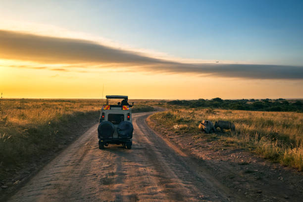 Ol Doinyo Lengai Volcanology Tour: Explore Tanzanias Unique Active Volcanostart an extraordinary Ol Doinyo Lengai Volcanology Tour to witness one of the world's most unique active volcanoes. This tour offers an…View package
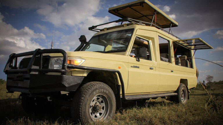 5-Day Tanzania Gemstone And Geology Expedition: Explore Earths TreasuresA 5-day expedition into Tanzania's rich geological landscapes, focusing on gemstone exploration and understanding Earth's processes. Perfect for…View package3-Day Northern Tanzania Mining Tour: An In-Depth Exploration For 2026-2027Explore Tanzania's rich mineral heritage with a focused 3-day mining tour in the North. This specialized itinerary offers a rare glimpse into…View package
 2-Day Tanzania Gemstone Discovery Package: Unearthing Treasures 2026-2027Discover Tanzania's rich gemological heritage with our exclusive 2-Day Gemstone Discovery Package. This immersive experience takes you from…View package
 1-Day Mahenge Spinel Mining Experience: A Gemstone Adventure In TanzaniaExplore the vibrant world of gemstones with a unique 1-Day Mahenge Spinel Mining Experience in Tanzania. This immersive tour offers a hands-on…View package
 1-Day Tanzanite Buying Tour From Moshi: Your Ultimate Gemstone AdventureExperience a unique 1-Day Tanzanite Buying Tour from Moshi, immersing yourself in the world of this rare gemstone. Perfect for gem enthusiasts…View package
 1-Day Tanzanite Buying Tour From Arusha: Your Ultimate Gemstone AdventureExperience a fascinating 1-day tour from Arusha focused on the acquisition of the rare Tanzanite gemstone. This unique adventure takes you to…View package